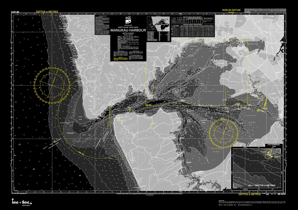
Manukau Harbour - Black Mamba
$95.00
This is a limited edition 1 of 50 cARTographic print. Born from the official Land Information New Zealand navigational maps with Here + There's sense of fun and style.
The Design:
Watch out for The Black Mamba it's deadly. With its black background, light grey land masses and yellow highlights it's moody and intoxicating.
The Area:
This map covers the Manukau Harbour including West coast beaches like Bethells, Piha and down to Whatipu, as well as the Waitakere ranges and Auckland suburbs like Laingholm, Titirangi, Hillsborough, Mt Roskill, Sandringham, Greenlane, Onehunga, Mt Wellington, Otahuhu, Mangere, Mangere Bridge and Papatoetoe. We're not finished yet... it also has Auckland Airport, Clarks Beach and South Head!
The Details:
Your map comes in A1 size (840mm x 594mm), printed on quality thick 250gsm matt finish paper and is rolled up carefully in tissue paper for added protection and delivered securely in a durable tube. Which is also perfect for sending to someone as a gift!
The Delivery:
Your map will be dispatched within 3-7 working days of order being received, a signature for proof of delivery is required.
-
Pin it

